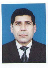
Mehman Pashayev eng

Candidate of geographical sciences,
Working telephone: (+994 12) 439-09-74
E-mail: mexbaliyev@box.az, mexbaliyev@baku.az.
1958 – Born in Agsu district of Azerbaijan 1965-1975 – Study at secondary school in Agsu district. 1975-1980 - – Study at geographic faculty at Azerbaijan State University. Married. Have two children.
EDUCATION AND ACADEMIC DEGREES OBTAINED- 1994 - Got the candidate degree in geography sciences.
- 1980-1983 - worked as the engineer in 332-nd Incorporated Complex Expedition, of the 16 th ogranization of Main
- Geodesies and Cartography at ministerial council of USSR.
- 1983-1992 – head laboratorian at Geodesy and Cartography faculty of Geography department.
- 1992-1997 – teacher
- 1997-2004 – senior teacher
- 2004 – associate professor.
- The sabjects which he teaches to bachelors and masters: Nature cartography, designing and decorating of socially economic maps and others.
- Author of 14 articles, 10 thesis and 6 methodical works.
- Morphometric research of o relief in the experimental purposes. Historical Great Silw Way.
- 2007 – International symposium on modern cataclysms and global problems of a modern civilization.
- 2007 – Innovation technologies and uniform development of the mountain states. International conference. Vladikavkaz.
- Development of a technique of drawing up and of the contents of an agro-geomorphologic map of direction slopes. Kiev. Ukraine. 2008.
- Practice of drawing up of a map of geodynamic activity of slopes and cartographic statistical analysis. (On the basis of Ayrichay research field.) St. Petersburg. Russia. 2007.
- Drawing up of a map of ball estimation of slopes. St.Petersburg.Russia. 2007.
- Morphometric reseach of geometrical properties of hillsides / On behalf of the southern slope of Big Caucasus which is in territory of Azerbaijan. Moskov. Russia. 2007.
- Drawing up of geotourism maps of Azerbaijan Republic. Vladikavkaz. Russia. 2007.
- Drawing up of a map of ecogeomorphologic intensity of slopes and morphometric analysis. Vladikavkaz. Russia. 2007.
- Practice use of a ball estimation of morphometric parameters for the complex characteristic of erosive destruction of a relief. Irkutsk. Russia. 2006.
- Development of the contents and technique of drawing up of the engineer-geomorphologic maps. Irkutks. Russia. 2006.


