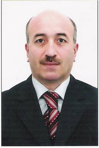
Magsad Gojamanov

Dr. of Science, Professor
Phone: (99412) - 439-09-74
Fax: (99412) - 598-33-76
e-mail: mgodja@yandex.ru
Was born in 20-th marth 1960 year in village Dash Salahlu of Kazakh district of Azerbaijan Republic 1967-1977 years went to secondary school № 2 in village Dash Salahlu of Kazakh district 1977-1982 years went to full-time tuition of Geodetic faculty of Moscow State University of Geodesy and Cartography ((MIIGAiK) on speciality « astronomy-geodesy» with specialization on marine geodesy 1986-1989 years went to full-time tuition of postgraduate studies in MIIGAiK 2002-2005 years went to full-time tuition of doctoral studies in MIIGAiK He is first and single Azerbaijanian, which received a degree Doctor of science in the field of geodesy-cartography sciences A member of the dissertational council for protection of the doctoral dissertations attached to Geography institute named avter H. Aliev of Azerbaijan National Academy of Sciences Since February of 1992 year works in Baku State University Married, two children
EDUCATION AND ACADEMIC DEGREES OBTAINED- 2002-2005, Doctoral studies in MIIGAiK, «Work out modern technologies for reconstruction and development of the State Geodetic Networks by account the territorial features »
- 1986-1989, PhD studies in MIIGAiK, «Work out methods for combined use Navigation Satellite and Earthly Geodesic Systems for defining the object coordinates in sea»
- 1977-1982, Engineer of astronomy-geodesy with specialization on marine Geodesy
- 1982-1986, 16-th Enterprise of Main Geodesy and Cartography Office(QUQK) attached to Council of Ministers USSR (present the State Committee by Land and Cartography of Azerb.R-lic), Engineer of geodesy, High inspector on the Depart. of Technical control
- 1986-1989, Moscow University of Geodesy and Cartography,Post-graduate studies
- 1989-1992, Azerbaijan Petroleum Academy, Head of laboratory, Assistant-lecturer
- 1992-1994, Depart. of Geodesy and Cartography, Baku State University, Senior lecturer
- 1994-2006, Depart.of Geodesy and Cartography, Baku State Univ-ty, Assistant-professor
- 2006- Present, Professor, Department of Geodesy and Cartography, Baku State University
- Taught lessons: Geodesy, Calculation and adjustment of geodetic measurements, Geodetical basis of maps, Geodesy and
- Cartography, High Geodesy, Space Geodesy
- Scientific works: 60 Scientific articles, 2 monographies, 1 textbook for studenrs of high school, 1 Russian- Azerbaijani dictionary, consisting 12000 cartography- geodetic terms,
- 2 author's certificates, 25 educational programs and methodical works
- Scientific -and- practical problems of High geodesy, Spase geodesy and Marine geodesy, Mathematical processing of geodetic measurements, Creation and development of Geodetic Networks by use modern satellite technologies
- 2003, Moscow, Russia; GEOFORUM: « Present-day condition and development perspectives of Cartography- geodetic science», International scientific and technical symposium
- 2003, Lvov, Ukraine; «Present-day achievements of geodetic science and practice». 8-th International scientific and technical conference
- 2004, Moscow, Russia; GEOFORUM: « Present-day condition and development perspectives of Cartography- geodetic science», International scientific and technical symposium
- 2004, Moscow, Russia; International scientific and technical conference, dedicated to 225-th years anniversary of MIIGAiK
- 2007, Baku, Azerbaijan; International scientific-practical symposium: natural cataclysms and global problems of the modern civilization.
- 2008, Baku, Azerbaijan; International scientific conference, dedicated to 85-th years anniversary of National lider Heydar Aliev
- 2008, The connections of the systems of geodetic coordinates
- 2008, A selection and estimation of accuracy of the interpolation method for geoidal height(or height’s differences)
- 2008, The construction methodica of detailed map of quasigeoidal heights on the territory of Azerbaijan
- 2007, The condition of State Geodetic Networks of Azerbaijan Respublic and the modern technoloqies of its reconstruction and developments
- 2007, About the development of the altitude maintenance system on the territory of Azerbaijan
- 2006, Underwater geodetic network in sea and the features of its construction
- 2006, A geodetic monitoring of sea objects positions
- 2006, The Connection of satellite and ground systems of the normal heights in Azerbaijan
- 2006, The establishment principle of satellite normal heights in Azerbaijan
- 2005, A priori estimation results of the adjusted elements accuracy of Azerbaijan projecting network
- 2004, A definition of ground points coordinates by useing sea trestle
- 2004, The possible variants of scheme and program for the reconstruction and development of Azerbaijan State Geodetic Networks
- 2004, The features of detailed study of quasigeoidal figure on Azerbaijan territory
- 2004, A condition analysis of the present-day State Geodetic Networks of Azerbaijan
- 2002, About the concept for the reconstruction and development of State Geodetic Networks of Azerbaijan Respublic
- 2000, Mathematical processing of geodetic measurements. Ttextbook for studenrs of high school (on Azerbaijan language )
- 2001, Russian- Azerbaijani dictionary, consisting 12000 Cartography- geodetic terms
- 2003, A definition of the traffic parameters for the objects by use Kalman recurrent formulas (for example, a sea ship traffic ), Moscow
- 2008, A reconstruction and development of Geodetic Networks by use the satellite technologies, Moscow-Baku
- 2009, A geodetic monitoring and maintenance works in sea, Moscow-Baku
- An International expert in the field of geodetic science and geoinformatics in the framework of the International educational program Tempus(Bishkek, 2006)
- An opponent to R.N.Rajendra Prosal’s PhD dissertation work (Mysore university, India)


